

LotScan
Plan your project
The site plan for your building permit application, from your property survey
Take a photo of your property survey (in Quebec, your certificate of location): the AI detects lot lines, structures, pools and dimensions. You adjust the plan, then export it as a PDF, ready to attach to your building permit application.


English, French and SpanishPlans from Quebec, France, the United States and elsewhere
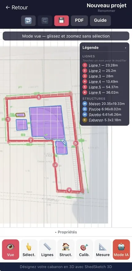
The app in pictures
From the imported survey to the PDF plan
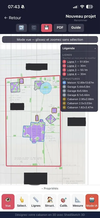
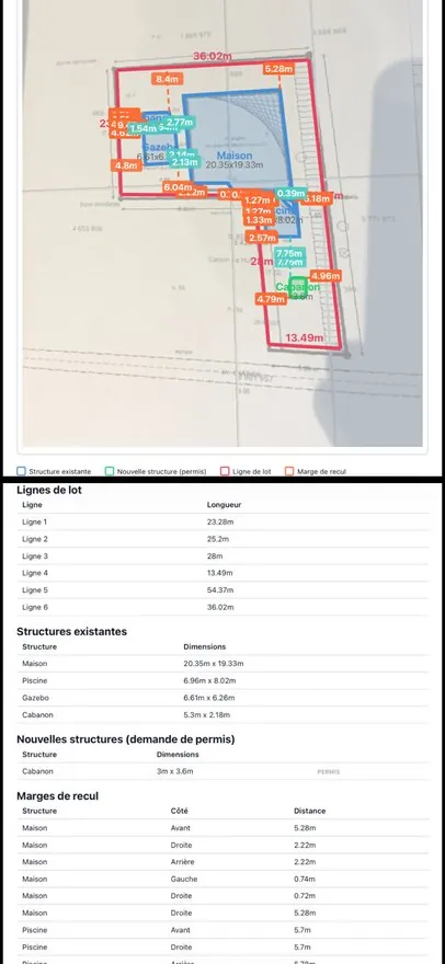
What the app does
Everything you need to analyze your lot
Artificial intelligence tools that turn a simple property survey into a professional site plan.
AI analysis
Lot lines, structures, pools and easements: everything is detected automatically by segmentation, in a few seconds.
Measurement extraction (OCR)
The measurements and dimensions written on the survey are extracted automatically by optical character recognition (OCR), in several passes.
Structure detection
House, garage, shed, pool: every structure on your lot is identified and vectorized.
Setbacks
The distances between the structures and the lot lines are calculated automatically. Check compliance with the regulations at a glance.
Site plan as a PDF
A professional plan, with a legend, dimensions and setbacks, for your permit application.
In three languages
In English, French and Spanish, and compatible with cadastral plans from Quebec, France, the United States and elsewhere.
How it works
4 simple steps
From a photo of your survey to a PDF site plan, in a few minutes.
Import your survey
Take a photo of your property survey or import an image of it from your device.
The AI analyzes the plan
It automatically detects lot lines, structures and pools, and extracts every measurement.
Edit and adjust
Add structures, correct dimensions, adjust the setbacks.
Export as a PDF
A professional site plan, ready to attach to your building permit application.
International
Compatible with cadastral plans from around the world
LotScan analyzes all types of survey plans and cadastral documents, whatever your country.
Quebec
Certificate of location (certificat de localisation)
France
Plan de bornage (boundary survey)
United States
Property survey, plot plan
United Kingdom
Land registry plan
Belgium
Plan de mesurage (measurement plan)
Switzerland
Plan de situation (site plan)
Frequently asked questions
What people ask us
What does LotScan detect on a property survey or certificate of location?
The AI automatically detects lot lines, structures (house, garage, shed, pool) and easements. The measurements and dimensions written on the survey are extracted by optical character recognition (OCR).
What’s in the exported site plan?
A PDF with the legend, the dimensions and the setbacks, that is, the distances between the structures and the lot lines. It’s ready to attach to your building permit application.
Can I correct the plan after the analysis?
Yes. Before you export the PDF, you can add structures, correct dimensions and adjust the setbacks.
Does LotScan work outside Quebec?
Yes. The app is compatible with cadastral plans from Quebec (certificate of location), France (plan de bornage), the United States (property survey, plot plan), the United Kingdom (land registry plan), Belgium (plan de mesurage) and Switzerland (plan de situation). It’s available in English, French and Spanish.
Related guides
Go further
Property Survey vs Site Plan vs Plot Plan: What You Need to Know
How AI Can Analyze Your Property Survey in Seconds
In the same family


Trust
Policies and support
Privacy
Terms
The subscription is optional and can be canceled in your App Store or Google Play account settings.
Ready to analyze your survey?
Download LotScan and turn your property survey into a professional site plan.